The best handheld GPS devices for backpacking help you stay oriented when trails are confusing, phone batteries are low, or cellular coverage disappears. The right model can provide dependable positioning, downloadable maps, a readable screen, and useful navigation tools without relying entirely on a smartphone.
This roundup compares 10 options across Garmin’s eTrex and GPSMAP lines, plus a satellite communicator and a rugged budget-friendly alternative. We focus on navigation reliability, battery performance, durability, mapping features, and the needs of different backpacking styles.
Best 10 Handheld Gps Devices for Backpacking Picks for 2026
Best for Off-Grid Communication
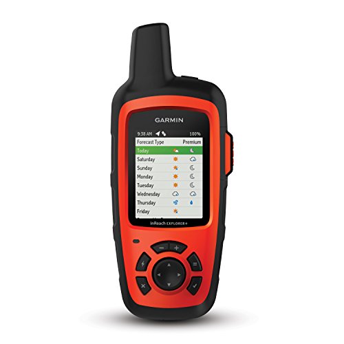
- Two-way satellite messaging and interactive SOS
- Preloaded topo maps with GPS routing
- 30-hour battery and IPX7 water resistance
Best For: Remote backpacking with communication needs
Best for Simple Color Navigation

- 2.6-inch color TFT display
- Worldwide basemap with shaded relief
- Waterproof, button-operated design
Best For: Traditional handheld GPS users
Best for Battery Life

- Solar charging for potentially unlimited battery life
- Up to 200 hours without solar charging
- Multi-band GPS and IPX7 water resistance
Best For: Long trips in sunny conditions
Best for Challenging Terrain
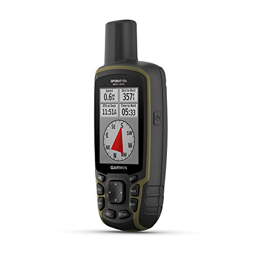
- Multi-band GPS for difficult signal environments
- Routable topo and public land maps included
- Compass and barometric altimeter built in
Best For: Dense forests, steep terrain, and technical routes
Reliable Trail Navigator

- 2.2-inch sunlight-readable color display
- TopoActive maps with GPS and GLONASS
- Up to 25 hours on two AA batteries
Best For: Simple, dependable backpacking navigation
Connected Mapping Upgrade
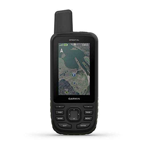
- 3-inch sunlight-readable color display
- GPS, GLONASS, and Galileo support
- Compass, altimeter, weather, and BirdsEye features
Best For: Feature-focused backpackers wanting connected navigation
Compass-Ready Trail Tool

- Three-axis compass and barometric altimeter
- TopoActive maps with routable trails
- Up to 25 hours on two AA batteries
Best For: Compact navigation with added terrain tools
Compact Topo Navigator

- 3.2-inch sunlight-readable screen with physical buttons
- Multi-GNSS, compass, altimeter, and USA topo maps
- Up to 36 hours of rechargeable battery life
Best For: Backpackers seeking built-in USA maps and long rechargeable runtime
Long-Battery Trail Companion

- Up to 168 hours standard or 1,800 hours expedition mode
- Field-replaceable AA batteries and IPX7 water resistance
- Multi-GNSS support plus Garmin Explore app connectivity
Best For: Multi-day backpackers prioritizing extreme battery endurance
Simple Worldwide Navigator

- Rugged IPX7 waterproof design with worldwide basemap
- GPS, WAAS, HotFix, and GLONASS support
- Up to 20 hours on two AA batteries
Best For: Hikers needing basic, durable waypoint and track navigation
Best for Off-Grid Communication – Garmin inReach Explorer+
For backpackers who need more than basic positioning, the Garmin inReach Explorer+ combines GPS navigation with two-way satellite messaging. Its global Iridium coverage, interactive SOS, and preloaded topo maps make it a strong choice for remote trips, provided you maintain a satellite subscription.
Best For: Backpackers who want navigation plus emergency communication in areas without cellular service.
Pros:
- Two-way messaging and interactive SOS through the Iridium satellite network
- Preloaded DeLorme topo maps with on-screen GPS routing
- Up to 30 hours of battery life and IPX7 water resistance
- Built-in compass, barometric altimeter, and accelerometer
Cons:
- Satellite messaging and SOS features require a subscription
- Small 2.3-inch display may feel limited for detailed map viewing
The Explorer+ is a practical safety-oriented option for remote backpacking, especially when dependable communication matters as much as route guidance.
Best for Simple Color Navigation – Garmin GPSMAP 62sc
The Garmin GPSMAP 62sc is a straightforward handheld GPS for backpacking, with a color display, worldwide basemap, shaded relief, and a waterproof design. Its button-operated layout and replaceable AA battery setup suit hikers who prefer a traditional navigator.
Best For: Backpackers seeking a durable, uncomplicated GPS with basic mapping and a built-in camera.
Pros:
- 2.6-inch 65K color TFT display
- Worldwide basemap with shaded relief
- Waterproof design for outdoor use
- 5 MP autofocus camera with automatic geotagging
Cons:
- Older model with a listed 2011 model year
- Battery life is rated at up to 20 hours
- Uses USB connectivity rather than Bluetooth
The 62sc remains a sensible choice for users who value physical buttons and core GPS functions, though its older platform may offer fewer modern conveniences.
Best for Battery Life – Garmin eTrex Solar
The Garmin eTrex Solar is an appealing handheld GPS for backpacking when minimizing charging stops is a priority. Its solar charging can provide unlimited battery life in sunny 75,000-lux conditions, while multi-band GPS and a high-contrast screen support everyday trail navigation.
Best For: Sunny-weather hikers who want exceptionally long battery life in a compact, easy-to-use GPS.
Pros:
- Solar charging can provide unlimited battery life in suitable sunlight
- Up to 200 hours without solar charging
- Multi-band GPS for improved positional accuracy
- IPX7 water resistance and a sunlight-readable 2.2-inch display
Cons:
- Solar performance depends on strong sunlight and a stated 75,000-lux condition
- Smaller screen may provide less map detail than larger models
- Some app, weather, and update features require a compatible smartphone
For long trips where recharging is difficult, the eTrex Solar stands out for endurance, while its compact display keeps it focused on essential navigation rather than expansive map viewing.
Best for Challenging Terrain – Garmin GPSMAP 65s
The Garmin GPSMAP 65s is built for backpackers navigating difficult signal environments. Expanded GNSS support and multi-band technology are designed to improve accuracy in forests, steep terrain, and urban canyons, while the button-operated body adds a compass, barometric altimeter, and routable topo mapping.
Best For: Hikers and backpackers who regularly travel through dense trees, steep country, or other challenging terrain.
Pros:
- Multi-band technology and expanded global satellite support
- 2.6-inch sunlight-readable color display
- Routable TopoActive maps and U.S. federal public land mapping
- Three-axis compass, barometric altimeter, Bluetooth, and ANT+
Cons:
- Listed battery life is up to 16 hours
- Uses a button-operated interface rather than a touchscreen
- Some planning and track-management features require a compatible smartphone
The GPSMAP 65s is a strong fit for accuracy-focused navigation, particularly where trees and terrain can make ordinary GPS reception less dependable.
Reliable Trail Navigator – Garmin eTrex 22x
For hikers seeking dependable handheld GPS devices for backpacking, the Garmin eTrex 22x offers a straightforward, rugged design with a sunlight-readable 2.2-inch color display. Its preloaded TopoActive maps, GPS and GLONASS support, and up to 25 hours of battery life make it a practical choice for day hikes and longer trips.
Best For: Backpackers who want reliable mapping, long battery life, and simple button controls.
Pros:
- Preloaded TopoActive maps include routable roads and trails.
- GPS and GLONASS support can improve tracking in challenging environments.
- Up to 25 hours of use with two AA batteries.
- 8 GB of internal storage plus a microSD card slot supports additional maps.
Cons:
- The 2.2-inch display is smaller than the screen on premium models.
- Button controls and the non-touchscreen interface may feel less modern.
The eTrex 22x focuses on core navigation rather than advanced sensors or a large display. It is a sensible, battery-friendly option for backpackers who value durability and uncomplicated operation.
Connected Mapping Upgrade – Garmin GPSMAP 66s Renewed
The renewed Garmin GPSMAP 66s is one of the more feature-rich handheld GPS devices for backpacking in this group. It combines a larger 3-inch sunlight-readable display with multi-GNSS support, a three-axis compass, a barometric altimeter, and wireless features for weather and geocaching updates.
Best For: Backpackers who want a larger screen, added elevation and direction sensors, and connected features.
Pros:
- Large 3-inch sunlight-readable color display is easy to view.
- Supports GPS, GLONASS, and Galileo satellite systems.
- Includes a three-axis compass and barometric altimeter.
- Supports BirdsEye imagery, Active Weather, and Geocaching Live features.
Cons:
- The listed battery life is up to 15 hours, shorter than the eTrex models here.
- As a renewed product, it has a 90-day limited warranty.
The GPSMAP 66s is a strong fit when navigation extras and screen size matter more than maximum battery endurance. Its renewed status and shorter listed battery life are the main factors to weigh before buying.
Compass-Ready Trail Tool – Garmin eTrex 32x
The Garmin eTrex 32x adds useful orientation tools to the compact eTrex platform, making it a capable choice among handheld GPS devices for backpacking. It includes TopoActive maps, a sunlight-readable 2.2-inch display, GPS and GLONASS support, and the same long battery rating as the eTrex 22x.
Best For: Backpackers who want compact mapping with a three-axis compass and barometric altimeter.
Pros:
- Adds a three-axis compass and barometric altimeter for orientation and elevation information.
- Preloaded TopoActive maps offer routable roads and trails.
- Up to 25 hours of battery life with two AA batteries.
- 8 GB of internal storage and a microSD slot accommodate map downloads.
Cons:
- The 2.2-inch screen provides less viewing area than the GPSMAP 66s.
- Its compact display may require more scrolling when reviewing maps.
The eTrex 32x is a practical step up from the eTrex 22x for hikers who value a compass and altimeter. It keeps the lightweight, long-running format while adding tools that are useful when terrain and elevation matter.
Compact Topo Navigator – NiesahYan Handheld GPS
For backpackers who want a bright, button-operated device with built-in maps, this NiesahYan is a practical option among handheld GPS devices for backpacking. Its 3.2-inch sunlight-readable screen, multi-GNSS support, and rechargeable battery are suited to extended days on the trail.
Best For: Backpackers who want preloaded USA topographic maps, long rechargeable battery life, and straightforward physical controls.
Pros:
- Sunlight-readable 3.2-inch display with physical buttons and an anti-slip design
- Supports GPS, Galileo, BeiDou, and QZSS for positioning in challenging environments
- Includes a 3-axis compass, barometric altimeter, USA topo maps, and 32 GB of storage
- IP66 water resistance and up to 36 hours of rechargeable battery life
Cons:
- Its built-in maps are specifically described as USA Topo maps
- The non-touchscreen interface may feel less familiar to users who prefer touch controls
This model stands out for combining useful navigation sensors, generous storage, and a bright screen in a compact handheld format. It is especially appealing when rechargeable power and USA trail mapping matter more than smartphone-style connectivity.
Long-Battery Trail Companion – Garmin eTrex SE
The Garmin eTrex SE is a strong choice for backpackers prioritizing battery endurance and a compact, sunlight-readable display. Among handheld GPS devices for backpacking, it offers multi-GNSS tracking, field-replaceable AA batteries, and optional smartphone connectivity through the Garmin Explore app.
Best For: Multi-day hikers who want exceptional battery life, replaceable batteries, and app-connected planning features.
Pros:
- Up to 168 hours in standard mode or 1,800 hours in expedition mode
- Uses two field-replaceable AA batteries, helping simplify remote trips
- Supports GPS, GLONASS, Galileo, BeiDou, and QZSS
- IPX7 water resistance and a 2.2-inch high-resolution sunlight-readable display
Cons:
- AA batteries are not included
- Additional mapping, weather, updates, and planning features require pairing with a compatible smartphone and the Garmin Explore app
The eTrex SE is particularly compelling for long trips where charging opportunities are limited. Its small screen and button controls favor efficient navigation over a large-map experience, while Bluetooth connectivity adds planning and update options when a phone is available.
Simple Worldwide Navigator – Garmin eTrex 10
The Garmin eTrex 10 is a basic, rugged navigation tool for backpackers who prefer simple button-operated guidance and replaceable batteries. It is one of the more straightforward handheld GPS devices for backpacking, with a worldwide basemap, paperless geocaching support, and IPX7 water resistance.
Best For: Budget-conscious hikers who need dependable basic tracking, waypoint storage, and long-lasting AA battery power.
Pros:
- Rugged design with IPX7 waterproofing for rain and splashes
- Preloaded worldwide basemap and support for paperless geocaching
- GPS with WAAS, HotFix, and GLONASS support for positioning and signal reliability
- Runs for up to 20 hours on two AA batteries
Cons:
- Its 2.2-inch monochrome display has a low 128 x 160 resolution
- Only 6 MB of storage is listed, limiting its mapping capability
- The supplied notes describe a wired USB connection rather than wireless connectivity
This eTrex 10 makes the most sense when you want a durable GPS for tracks, waypoints, elevation points, and basic route awareness without paying for advanced mapping features. Its monochrome screen and limited storage are trade-offs for its simple operation and AA-powered design.
How We Picked These Handheld Gps Devices for Backpacking
We selected models that cover a range of backpacking needs, budgets, and experience levels. Our comparison emphasizes satellite reception, waypoint and route management, screen readability, physical controls, battery options, mapping support, and resistance to outdoor conditions. We also considered whether each device adds practical features such as an electronic compass, barometric altimeter, expanded satellite compatibility, or two-way satellite messaging.
A dedicated GPS should complement—not replace—basic navigation skills. Before a trip, download maps, load your route, test the controls, and carry a paper map and compass as backup.
Quick Comparison
| Best For | Look For |
|---|---|
| Simple route recording | Large buttons, straightforward menus, long battery life |
| Detailed trail navigation | Color display, preloaded or downloadable maps, route planning |
| Dense forest or steep terrain | Multi-band or expanded satellite support, electronic compass |
| Emergency communication | Two-way satellite messaging and an active service plan |
| Minimal charging access | Replaceable batteries or solar-assisted operation |
Key Buying Factors for Handheld Gps Devices for Backpacking
Satellite Reception and Accuracy
GPS, GLONASS, and Galileo support can improve positioning availability in challenging environments. Multi-band technology is especially useful near cliffs, dense vegetation, and other areas where signals may reflect or weaken. No receiver is perfect, so keep the antenna oriented toward open sky when possible.
Maps, Screen, and Controls
Color screens make contours, tracks, and waypoints easier to interpret, while monochrome displays often conserve power. A sunlight-readable screen matters on exposed trails. Physical buttons are useful in rain, cold, or when wearing gloves; touchscreen models may be faster for map interaction but can be less convenient in harsh conditions.
Battery Life and Charging
Check whether the device uses standard replaceable batteries, a rechargeable pack, or solar assistance. Consider the advertised runtime in the navigation mode you will use, not just standby time. Bring spare batteries or a power bank for multiday trips.
Durability and Navigation Sensors
Look for water resistance, a rugged housing, and a size you can operate securely. An electronic compass provides directional information while stationary, while a barometric altimeter can help track elevation and recognize progress on climbs.
Satellite Messaging
A satellite communicator can send messages and share location beyond cellular range, but it requires an account and subscription. Choose this feature when communication and emergency support are priorities—not simply because it is included.
Who Should Buy Which Handheld Gps Devices for Backpacking?
Choose a basic eTrex-style navigator if you want dependable waypoint tracking, low weight, and simple operation at a lower price. Step up to a color-screen GPSMAP or higher-end eTrex model if you need clearer maps, more storage, improved sensors, or better performance in difficult terrain.
Backpackers who regularly travel beneath tree cover, among canyon walls, or across complex routes should prioritize expanded satellite support or multi-band reception. If staying in contact with family or requesting help is central to your trips, an inReach Explorer+ is the more appropriate choice because it combines navigation with satellite communication. For any model, choose the device whose controls, battery system, and mapping workflow you will actually use confidently outdoors.